Eole Eyes
Leveraging drone sensors
for decision support
for decision support
© Kees van het Maalpad (Bright Cape)
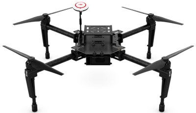
DRONES + SENSORS
Aerial view allied to infrared vision (or other sensors) give an enhanced vision of a damage scene.
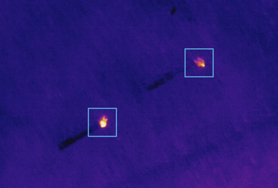
SENSOR DATA
ANALYTICS
ANALYTICS
From infrared and standard captured images, data analysis identify potential danger targets or sources.
USER EXPERIENCE
Quick access is offered to the relevant data through the user interface for quick decision support.
The interface also offers a view from above of the damage scene.
Assisted Control
Users indicates objectives on the scene and let the planner compute trajectories and view angles.
At any moment, a certified telepilot may take full control of the drone to avoid it to fly over people on the scene or react to an unpredictible event.
Univ Rennes 1 / IRISA
Campus universitaire de Beaulieu
263 Avenue du Général Leclerc - Bât. 12
35042 RENNES Cedex - France
This activity has received funding from the European Institute of Innovation and Technology (EIT).
This body of the European Union receives support from the European Union’s Horizon 2020 research and innovation programme.